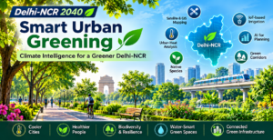

Why the future of urban greenery depends on more than planting trees — and how climate data, native species, GIS, IoT and long-term maintenance can help build a cooler, healthier and more resilient National Capital Region.
Introduction: The next green revolution must be smarter
Delhi-NCR does not need another plantation drive that is measured only by the number of saplings planted.
It needs a different approach to urban greening: one that identifies where greenery is most urgently needed, selects vegetation suited to local conditions, protects existing natural ecosystems, measures actual environmental benefits and ensures that planted trees survive long enough to become part of the urban landscape.
The distinction matters.
A tree planted along a road but left without adequate water may not survive its first summer. A park developed without considering surrounding land use may provide limited relief to densely populated neighbourhoods. A plantation designed without understanding local airflow, soil conditions and water availability may deliver less cooling than expected.
Urban greenery is not simply an aesthetic feature. It is infrastructure.
Well-designed green spaces can provide shade, reduce exposure to extreme heat, support biodiversity, improve the experience of walking and cycling, absorb some stormwater, protect soil and make neighbourhoods more liveable. But these benefits depend on where greenery is located, how it is designed and how it is maintained.
For Delhi-NCR, the opportunity is to move from plantation targets to climate-intelligent green infrastructure — a regional system of parks, urban forests, roadside shade, restored water bodies, green corridors and neighbourhood vegetation planned around measurable environmental and public-health outcomes.
This article examines how that transformation could work, what current government initiatives already provide, and where technology can help close the gap between planting a tree and building a genuinely greener city. It is the second article in our Delhi-NCR 2040: From Pollution Crisis to a Smarter, Cleaner and More Productive Urban Region series.
1. Why Delhi-NCR needs a new approach to urban greening
Delhi-NCR faces a combination of environmental pressures that make conventional plantation programmes insufficient on their own.
Rising heat and the urban heat-island effect
Built-up urban areas often experience higher temperatures than their surrounding rural areas. This is commonly described as the urban heat-island effect.
Several factors contribute to it:
- Concrete, asphalt and other built surfaces absorb and retain heat.
- Reduced vegetation means less shade and less evaporative cooling.
- Dense development can restrict natural ventilation.
- Buildings, roads, vehicles and air-conditioning systems add anthropogenic heat.
- Loss of wetlands and natural water systems reduces the landscape’s ability to regulate local conditions.
The impact is not distributed evenly. A neighbourhood with tree-lined streets, parks and shaded pedestrian routes can offer a very different outdoor experience from a densely built area with little vegetation and extensive paved surfaces. This means that city-wide averages are not enough. Planners need to understand which neighbourhoods, roads, schools, markets, industrial areas and public spaces experience the greatest heat exposure.
Delhi’s climate vulnerability is already documented
The Government of India’s July 2026 parliamentary information on urban heat mitigation reported that Delhi’s revised State Action Plan on Climate Change includes a climate vulnerability assessment based on India Meteorological Department data for 1991–2020 and IPCC AR6 climate scenarios.
The assessment identified rising temperatures and heatwaves as major climate vulnerabilities. It projected an increase in summer maximum temperatures of approximately 1.5°C under SSP2-4.5 and up to 2.1°C under SSP5-8.5 by mid-century. The same assessment identified South Delhi as the most climate-vulnerable district and New Delhi as the least vulnerable among the districts assessed.
These projections reinforce the need to treat urban heat as a planning and infrastructure issue, not merely a seasonal inconvenience.
The challenge extends beyond Delhi
The NCR is an interconnected urban region. Heat exposure, land-use change, water stress and loss of natural ecosystems do not stop at municipal boundaries. Gurugram, Faridabad, Noida, Greater Noida, Ghaziabad and other NCR settlements face different combinations of urban density, industrial activity, construction, transport infrastructure and natural landscape.
A green strategy designed only around central Delhi would therefore miss much of the regional challenge. The region needs a common planning framework, supported by local assessments and implementation by the relevant state, city and district authorities.
2. The first principle: plant for the location, not for the target
Plantation programmes are often communicated through the number of saplings planted. That number is easy to report. It is also an incomplete measure of environmental performance.
A sapling planted is not necessarily a surviving tree. A surviving tree is not necessarily in the right location to provide meaningful shade. And a large number of trees does not automatically translate into a proportionate reduction in heat exposure.
Different locations need different interventions
The objective should not be to apply the same plantation template everywhere. A dense commercial street, a residential colony, a highway edge and a wetland require different approaches. Even within the same neighbourhood, the choice of species, spacing, irrigation and maintenance may need to vary.
Map the problem before selecting the solution
A practical urban greening programme should begin with a spatial assessment of: existing tree canopy and vegetation; built-up density and impervious surfaces; land surface temperature and air temperature; humidity and local ventilation; population density and vulnerable groups; pedestrian activity and public-space usage; water availability and soil characteristics; and existing parks, forests, water bodies and ecological corridors.
This information can help identify priority locations rather than distributing plantation targets uniformly. The principle is simple: green investment should follow environmental need, not administrative convenience.
3. A major research finding: more greenery does not always mean better cooling
One of the most important developments in urban climate research in 2026 is a study by researchers at IIT Gandhinagar, published in Nature Communications.
The study, titled Dense Canopies Reverse the Cooling Effect of Urban Greening in Humid Cities, analysed 138 Indian cities using data from 2003 to 2020. It examined how vegetation characteristics, urban density and climatic conditions relate to the Heat Index — a measure that combines temperature and humidity to better represent how hot conditions feel to people.
The findings challenge the assumption that increasing vegetation uniformly reduces heat stress.
Why this matters
Trees cool their surroundings through two important mechanisms: shade (tree canopies block direct solar radiation, reducing heat exposure for people, buildings and ground surfaces) and evapotranspiration (plants release water vapour through transpiration, while water evaporates from surrounding surfaces, contributing to cooling).
However, in relatively dry environments, additional moisture released by vegetation can contribute to cooling. In humid and densely built environments with limited ventilation, increased moisture may not disperse efficiently. Under some conditions, this can increase perceived heat stress even when shade provides local relief.
The IIT Gandhinagar study found that the relationship between vegetation and Heat Index varied with climate, canopy characteristics and urban form. It also found that very high canopy activity was associated with higher Heat Index in some humid and dense urban settings.
Important caveat: The researchers themselves caution that their analysis is city-scale and does not yet provide species-specific or street-level prescriptions. It should therefore inform planning principles, not be interpreted as a ready-made planting formula for every NCR neighbourhood. (Source: IIT Gandhinagar / Nature Communications, May 2026 — exact article URL to be verified before live publication.)
What Delhi-NCR should learn
The region needs a more sophisticated approach to green infrastructure. This means prioritising shade where people are exposed to direct heat; considering local humidity and ventilation when designing dense green spaces; selecting species based on local climate, soil, water and ecological suitability; avoiding obstruction of essential ventilation corridors; combining trees with parks, open spaces, water-sensitive design and suitable surface materials; and measuring actual heat exposure and outdoor comfort, not only vegetation coverage.
The most effective green city is not necessarily the city with the densest canopy everywhere. It is the city that uses vegetation intelligently to improve environmental conditions where people need it most.
4. Native species and biodiversity: build an ecosystem, not a plantation inventory
Species selection is one of the most important decisions in any large-scale greening programme. A tree that grows quickly but requires excessive irrigation or struggles with local soil conditions may not be a sustainable choice. A plantation that uses a narrow range of species may also be more vulnerable to pests, disease and environmental stress.
Why native and locally suitable species matter
Native and regionally appropriate vegetation can offer better adaptation to local climatic and soil conditions; support for local insects, birds and other biodiversity; reduced risk of introducing unsuitable or invasive species; greater potential for long-term ecological integration; and opportunities to restore natural habitats rather than creating purely decorative landscapes.
However, “native” should not become a simplistic label. A species native to one part of the wider region may still be unsuitable for a particular roadside, soil type or water regime. Selection should be based on ecological suitability, root behaviour, mature canopy size, water requirements, maintenance needs and proximity to infrastructure.
Delhi has already recognised the importance of species suitability
The Delhi Forest Department’s Green Action Plan describes the use of soil testing to assess site conditions, including nutrient and moisture characteristics, so that suitable species and maintenance interventions can be identified. The department also reports work to modernise nurseries and increase the availability of saplings native to Delhi.
A practical species-selection framework
Before a plantation is approved, the responsible agency should document:
| # | Criteria |
|---|---|
| 1 | Whether the species is native or regionally appropriate |
| 2 | Expected mature height and canopy spread |
| 3 | Water requirements during establishment and maturity |
| 4 | Suitability for the local soil and drainage conditions |
| 5 | Root behaviour and potential impact on roads, pavements and underground utilities |
| 6 | Ecological value for local biodiversity |
| 7 | Maintenance and pruning requirements |
| 8 | Expected survival under local summer conditions |
A regional species database could make this process more consistent across Delhi, Haryana, Uttar Pradesh and Rajasthan. The database should be maintained by qualified forestry, horticulture and ecological experts rather than relying on generic online planting lists.
5. From plantation drives to green infrastructure networks
A collection of disconnected parks and roadside trees is not the same as a functioning green infrastructure system. The next step is to connect green spaces and natural ecosystems wherever land availability and ecological conditions permit.
Create connected green corridors
Green corridors can link parks, institutional campuses, urban forests, river systems, roadside vegetation and peri-urban natural areas. Their benefits can include improving habitat connectivity; supporting movement of birds and other wildlife; creating more continuous shaded walking and cycling routes; connecting neighbourhoods with public green spaces; supporting stormwater management where designed with appropriate drainage; and improving the continuity of ecological systems across urban boundaries.
In Delhi-NCR, planning should examine opportunities around existing natural and open-space systems, including the Ridge, the Yamuna floodplain, the Aravalli landscape, urban forests, water bodies and other protected or ecologically sensitive areas. These landscapes should not be treated as empty land available for beautification. Their ecological functions, legal protections and carrying capacities must be respected.
The Aravallis need a landscape-level approach
The Aravalli landscape is particularly important to the wider NCR ecological system. Its value extends beyond the number of trees it contains. It includes natural habitats, soil protection, water-related functions and ecological connectivity. Urban development and greening plans should therefore prioritise the protection and restoration of existing natural ecosystems rather than assuming that new plantations can compensate for the loss of mature natural landscapes. A plantation cannot quickly recreate the ecological value of an established forest or natural habitat.
Restore water bodies as part of green planning
Parks and trees are only part of the solution. Ponds, wetlands, lakes, drains and other water systems can play an important role in urban resilience when they are ecologically restored and properly managed. Water-sensitive urban design should connect: wetland and water-body restoration; native riparian vegetation; stormwater capture and infiltration; groundwater recharge where hydrogeologically appropriate; protection of natural drainage channels; and reuse of treated wastewater for suitable non-potable applications.
The aim is to create functioning blue-green infrastructure, not ornamental water features that require continuous freshwater supply.
6. Climate intelligence: use GIS, satellites and AI to decide where greening matters most
Urban greening is a spatial planning problem. The value of a tree or park depends heavily on its location and the environmental conditions around it. Geographic Information Systems (GIS), satellite imagery, climate datasets and AI-based analysis can help planners identify priority areas and evaluate interventions.
Build a regional green-infrastructure map
Delhi-NCR should progressively develop a common geospatial inventory containing: existing tree cover and canopy density; parks, gardens and urban forests; natural forests and protected ecological areas; water bodies, wetlands and drainage networks; land-use and building-density information; road networks and public transport corridors; heat exposure and vulnerability indicators; soil, slope and water availability; and plantation locations and maintenance responsibility.
The map should be updated regularly and made available to relevant planning and implementing agencies.
Satellite imagery can track change over time
Satellite data can help measure vegetation cover, canopy changes, land-surface temperature and the expansion of built-up areas. This allows planners to examine which neighbourhoods are losing vegetation; where built-up development is reducing open space; which areas consistently experience higher surface temperatures; and whether plantations are surviving and expanding their canopy over time.
Important distinction: Satellite-based measurements should not be confused with direct measurements of air temperature or human heat exposure. Land-surface temperature, air temperature and Heat Index are different indicators. A robust monitoring system should use them together, with ground observations where possible.
AI can help identify priority locations
AI models can combine multiple datasets — heat exposure, population density, tree-canopy coverage, pedestrian movement, age and vulnerability indicators, availability of public open space, and local humidity and ventilation characteristics — to identify areas where interventions may have the greatest potential benefit.
However, AI should support planning decisions, not replace field surveys or professional judgement. Its recommendations must be explainable, validated and updated when local conditions change.
Digital twins can support long-term planning
A city or regional digital twin can bring together spatial data, infrastructure information and environmental models. For green infrastructure, it could help planners compare different scenarios: what happens if a road corridor receives continuous shade; which neighbourhoods benefit most from new parks; how a proposed development might affect existing green corridors; and how alternative planting designs affect shade, ventilation and maintenance requirements.
The immediate priority, however, should be reliable GIS inventories and consistent datasets. A sophisticated digital twin built on incomplete or outdated information will not produce reliable decisions.
7. IoT: make green infrastructure measurable and maintainable
Plantation programmes often face a familiar operational problem: responsibility becomes unclear after the planting event. Who waters the sapling? Who checks its health? Who replaces it if it dies? Who verifies the contractor’s work? IoT can help convert plantation management into a measurable service.
Smart irrigation
Soil-moisture sensors can provide information about moisture levels around selected plants and green spaces. Combined with weather forecasts, irrigation controllers and water-use records, they can help maintenance teams avoid unnecessary watering; identify areas that need attention; schedule irrigation based on actual site conditions; detect abnormal water consumption; and improve the management of large parks and urban plantations.
Sensors should be deployed selectively. Not every roadside tree requires a connected device. High-value, water-stressed or operationally complex locations may justify the investment, while simpler sites can be managed through periodic field inspections.
Environmental monitoring
A distributed network of weather and environmental sensors can help measure air temperature, relative humidity, solar radiation, wind speed and direction, soil moisture, rainfall, and selected soil conditions. These measurements can be used to understand how local microclimates change after green interventions — for example, a shaded pedestrian corridor assessed against a comparable exposed location.
Geo-tagged plantation records
Every major plantation project should have a digital record containing: geographic coordinates; plantation date; species planted; number of saplings; implementing agency and maintenance contractor; watering and maintenance schedule; periodic survival and health observations; and replacement records. A mobile application can allow field staff to update plantation records with photographs and location information, supporting independent verification through sample-based field audits.
Predictive maintenance
Over time, historical records can help identify patterns. Repeated plant mortality in a particular location may point to poor soil conditions, inadequate irrigation, construction damage or unsuitable species selection. Analytics can help maintenance teams prioritise inspections and allocate resources before failures become widespread. The objective is not to put sensors on every tree. It is to create an accountable maintenance system supported by useful data.
8. The most important metric: tree survival, not saplings planted
Delhi already has experience with large plantation programmes. The Delhi Economic Survey 2025–26 reports that during 2024–25, approximately 57.55 lakh saplings were planted under the Green Action Plan, including trees, shrubs and bamboo. It also reports that 53.70 lakh saplings had been planted by January 2026 under the 2025–26 programme.
These are substantial plantation activities. But plantation numbers alone do not tell us how much additional canopy has been established, how many plants survived or whether the interventions improved local environmental conditions.
The Delhi Forest Department’s published Green Action Plan also describes third-party plantation audits and reports historical survival assessments for different implementing agencies and years. The figures vary across agencies and reporting periods, reinforcing the need for consistent monitoring rather than relying on a single headline survival number.
Introduce a survival-first accountability model
A better performance framework should track the full lifecycle of a plantation. Survival should be measured at defined intervals, with clear rules for replacements and independent verification. A contractor should not be considered successful merely because the contracted number of saplings was planted. The contract should include responsibility for establishment and maintenance, with payment milestones linked to verified outcomes.
Measure canopy growth, not just survival
A small sapling and a mature tree do not provide equivalent shade. The programme should therefore track canopy development over time, using a combination of field surveys, geo-tagged photographs and satellite-based monitoring. This would help answer a more meaningful question: how much additional functional green cover has actually been created and maintained?
9. What government initiatives already provide a foundation?
Delhi-NCR does not need to begin from zero. Several existing programmes and policy frameworks can support a more integrated approach. The opportunity is to connect them, improve their measurement and align them with a regional climate-intelligence framework.
A. NCR-wide greening strategy
In November 2025, the Ministry of Environment, Forest and Climate Change held a high-level review meeting on the greening strategy for Delhi-NCR. The meeting involved senior forest officials from Delhi, Haryana, Rajasthan and Uttar Pradesh. The stated direction was to develop a scientifically planned, technology-enabled and convergence-based approach, including detailed district-wise planning and community engagement.
The next step should be to translate such planning into measurable district-level programmes with identified sites, responsible agencies, maintenance commitments and common reporting standards.
B. Delhi Green Action Plan
The Delhi Forest Department coordinates the annual Green Action Plan with multiple greening agencies. Its published programme describes plantation targets, sapling distribution, third-party audits, soil testing and an increased focus on native saplings. This institutional experience can be strengthened through consistent geo-tagging, multi-year survival reporting and greater use of spatial planning.
C. AMRUT 2.0
The Ministry of Housing and Urban Affairs’ AMRUT 2.0 framework includes the development of parks and green spaces, rejuvenation of water bodies, GIS-based master planning and urban water-security reforms. The government’s July 2026 information on urban heat mitigation reported that 4,171 park projects covering 18,168 acres had been approved nationally, of which 3,458 parks covering 11,119 acres had been developed. It also reported a pilot programme, Building Heat Resilient Cities: A Strategic Pilot for Urban India, covering 12 cities, including Gurugram and Ghaziabad.
D. Heat Action Plans and climate planning
The National Disaster Management Authority’s heatwave guidance recommends vulnerability assessment and suitable mitigation measures in city Heat Action Plans. The Ministry of Housing and Urban Affairs has also issued urban green and urban planning guidelines that include green-city planning, open spaces, vegetation, water-body conservation and microclimate-responsive design. Delhi’s revised climate action planning already recognises urban green infrastructure and cooling corridors as part of its heat-resilience approach.
The challenge is to translate these policy directions into funded, measurable projects at the neighbourhood and district levels.
10. What international experience can teach Delhi-NCR
International examples are useful when they demonstrate a planning principle that can be adapted to local conditions. They should not be copied without considering climate, governance, land availability and maintenance capacity.
Singapore: greenery as part of urban infrastructure
Singapore’s urban greening approach is notable for integrating parks, roadside vegetation, green buildings and ecological corridors into the broader urban landscape. Its experience demonstrates the value of treating greenery as a connected system rather than a collection of isolated parks. What Delhi-NCR can learn: connect parks, public spaces, institutional campuses, roads and ecological corridors through long-term planning. Adapt the design to local water availability and climate rather than copying tropical planting densities.
Seoul: environmental data for urban management
Seoul has invested in environmental monitoring and digital urban infrastructure. Its S-DoT sensor network has been used to collect information such as particulate matter, temperature, humidity and noise at neighbourhood scale. What Delhi-NCR can learn: combine local climate observations with GIS and planning systems to identify environmental hotspots and evaluate interventions.
Melbourne: planning for urban forest resilience
Melbourne’s urban forest planning has emphasised canopy expansion, tree diversity, species resilience and the long-term management of urban trees. The broader lesson is that urban forestry requires a long-term asset-management approach, not just a planting programme. What Delhi-NCR can learn: establish long-term canopy targets, diversify species appropriately, monitor tree health and plan for the changing climate.
These examples are reference points, not ready-made templates. Delhi-NCR needs a model designed for its own semi-arid conditions, water constraints, urban density and regional governance structure.
11. A proposed Delhi-NCR Climate-Intelligent Greening Programme
The following is a proposed framework for the region. It is not a description of an already approved government programme. The objective should be to connect existing institutions and schemes through a common regional planning and monitoring approach.
Pillar 1: Create a regional green-infrastructure inventory
Develop a GIS-based inventory of existing green assets, ecological corridors, water bodies, plantation sites and priority heat-exposure areas. The inventory should use common definitions and be updated periodically.
Pillar 2: Prepare district and neighbourhood greening plans
Each district should identify priority locations based on heat exposure, population vulnerability, existing canopy, land availability and ecological importance. Plans should distinguish between: protecting existing natural ecosystems; restoring degraded landscapes; creating new parks and urban forests; improving roadside and pedestrian shade; greening public institutions; and restoring water bodies and associated vegetation.
Pillar 3: Establish a regional species and nursery framework
Develop a scientifically reviewed database of native and regionally suitable species, with guidance on soil, water, mature canopy, maintenance and ecological value. Nursery capacity should be aligned with the actual species and sites identified in district plans.
Pillar 4: Introduce plantation lifecycle accountability
Every significant plantation should have a geo-tagged record, a named maintenance agency and a multi-year survival commitment. Independent sample audits should verify reported results.
Pillar 5: Use climate and IoT data to evaluate performance
Deploy environmental monitoring selectively in priority locations. Combine ground measurements with satellite imagery and climate models to evaluate: heat exposure; shade availability; canopy development; soil moisture; water use; and local environmental conditions.
Pillar 6: Make communities long-term partners
Residents, resident welfare associations, schools, colleges, businesses and civil-society organisations can help maintain local green spaces. Community participation should not replace government responsibility. It should complement professional maintenance, transparent reporting and public accountability.
12. Who should be responsible?
A regional programme will require coordination, but it does not necessarily require creating a new authority. Existing institutions already have relevant responsibilities. A practical first step would be to identify an existing regional coordination mechanism and give it a clear green-infrastructure work programme, shared data standards and measurable responsibilities. The exact administrative arrangement should be determined by the participating governments and existing statutory mandates.
13. Financing: treat green infrastructure as a long-term urban asset
Urban greening is often funded as a one-time capital activity. This creates a structural problem: planting may receive budget approval, while maintenance remains uncertain. A more sustainable model should separately and transparently fund: site preparation and ecological assessment; planting and initial establishment; irrigation and maintenance; replacement and survival management; monitoring and independent verification; and long-term restoration and canopy management.
Potential funding channels include: relevant central and state urban-development schemes; AMRUT 2.0 projects where eligible; state and municipal budgets; urban forestry and environment programmes; Corporate Social Responsibility funding for suitable projects; public-private partnerships for defined maintenance or technology services; and institutional and campus-level green infrastructure investments. Funding should be linked to project outcomes wherever feasible.
Make the economic case
The economic value of green infrastructure extends beyond visual improvement. Potential benefits include improved outdoor comfort; reduced exposure to extreme heat; better conditions for walking and cycling; improved public-space usability; support for biodiversity; reduced stormwater runoff where landscape design allows; and potential reduction in heat-related productivity losses. These benefits should be measured carefully and should not be converted into financial savings without a defensible methodology.
14. How should Delhi-NCR measure success?
A serious programme needs indicators that reveal whether the region is becoming greener, cooler and more resilient. The following are proposed performance indicators, not existing official targets. Results should be reported at district and neighbourhood levels, not only as NCR-wide totals. Measurements should distinguish between outputs (number of saplings planted) and outcomes (additional tree canopy established, maintained and providing measurable environmental benefits). The second is the more meaningful measure of progress.
| Area | Proposed indicators |
|---|---|
| Tree survival | Survival rate at 1, 3 and 5 years; replacement rate; canopy area established |
| Canopy coverage | Tree canopy cover by district; change over time; priority neighbourhoods covered |
| Heat exposure | Land-surface temperature trends; heat-vulnerable areas with improved shade |
| Green corridors | Length and connectivity of ecological corridors; habitat-connectivity indicators |
| Water bodies | Number restored; ecological quality; associated vegetation established |
| Smart irrigation | Water use at monitored sites; moisture-triggered vs. scheduled irrigation |
| Accountability | Percentage of plantations with geo-tagged records; audits completed; variance |
| Community | Number of schools, RWAs and institutions actively maintaining local green spaces |
15. A practical roadmap to 2040
The transformation should be phased. Delhi-NCR does not need to wait until 2040 to begin, but it does need a consistent direction over multiple planning and budget cycles. These are proposed phases, not existing government commitments.
| Phase | Period | Priority | Expected result |
|---|---|---|---|
| Phase 1: Establish the evidence base | 2026–2028 | Create common regional GIS inventory; identify priority heat-exposure and low-canopy neighbourhoods; map existing forests, wetlands and ecological corridors; establish species-selection framework; standardise geo-tagging and survival reporting; select pilot locations; identify funding schemes | A common evidence base and a clear list of priority interventions |
| Phase 2: Scale neighbourhood and corridor interventions | 2028–2032 | Expand climate-informed street and neighbourhood greening; restore selected ecological and water-body corridors; improve shade around schools, hospitals, markets and transport nodes; introduce smart irrigation at selected high-priority sites; link plantation contracts to multi-year survival; publish district-level performance reports | Visible improvements in priority locations, supported by measurable maintenance and environmental data |
| Phase 3: Build a connected regional green network | 2032–2040 | Connect suitable green spaces and ecological corridors; integrate green infrastructure into new development; expand climate-responsive planning across municipal boundaries; use long-term monitoring to refine strategies; make green infrastructure performance part of regular urban planning and budget reviews | Green infrastructure becomes a permanent component of how Delhi-NCR plans, develops and manages its urban environment |
16. The role of the private sector and technology industry
Climate-intelligent greening also creates opportunities for India’s technology and infrastructure ecosystem. The programme could create demand for: GIS and geospatial analytics; satellite-based vegetation monitoring; IoT soil-moisture and environmental sensors; smart irrigation systems; climate-risk modelling; digital plantation-management platforms; AI-assisted heat-vulnerability mapping; urban forestry and landscape-management services; and water-efficient horticulture and nursery solutions.
There is an opportunity for Indian startups, engineering companies, research institutions and established technology providers to develop solutions suited to Indian urban conditions. But technology procurement should follow clearly defined operational needs. A municipality does not need a complex dashboard if field teams cannot maintain the data. The objective should be to procure measurable services and outcomes, not technology for its own sake.
Conclusion: From counting trees to creating cooler, healthier cities
Delhi-NCR has already undertaken significant plantation and urban greening activity. Government programmes, forest departments, development authorities and municipal agencies provide an existing foundation.
The next stage should be about improving the quality, location, connectivity and long-term performance of that investment. That means protecting natural ecosystems, selecting suitable species, prioritising heat-vulnerable neighbourhoods, restoring water systems, using climate data to guide decisions and ensuring that planted trees survive.
It also means recognising that green infrastructure is not separate from urban planning. It must be integrated with roads, public transport, housing, industrial development, water management and public health.
Technology can make this system more intelligent. GIS can show where interventions are needed. Satellites can track changes in vegetation. AI can help analyse heat exposure. IoT can support irrigation and maintenance. Digital records can make agencies accountable.
But the ultimate measure of success will not be the number of sensors installed or saplings distributed. It will be whether people experience more shade, cooler public spaces, healthier neighbourhoods and a more resilient urban environment.
Delhi-NCR 2040 should aim to become a region where every green investment is planned scientifically, maintained responsibly and measured by the benefits it delivers.
What comes next: The Delhi-NCR 2040 series
This article is the second instalment in our series exploring how Delhi-NCR can transform its environmental challenges into an opportunity for smarter, cleaner and more productive urban growth. Read the first article: Delhi-NCR 2040: From Pollution Crisis to a Smarter, Cleaner and More Productive Urban Region.
Upcoming articles in the series:
- Cleaner Industry, Stronger Economy: Rethinking Industrial Growth in Delhi-NCR — How industrial IoT, cleaner production, energy efficiency and better environmental monitoring can support economic growth while reducing pollution.
- Designing Cities Around People: Healthier Mobility and Urban Infrastructure — How public transport, electric mobility, walkability, shaded streets and climate-resilient public infrastructure can improve urban life.
- The Invisible Smart City: Transforming Waste, Water and Energy Infrastructure — How connected utilities, circular resource systems and smart infrastructure can improve efficiency and resilience.
- From Smart City Vision to Ground Reality: A 10-Year Transformation Roadmap for Delhi-NCR — Governance, financing, institutional coordination, technology and measurable milestones for delivering the 2040 vision.
Editorial note: The proposed programme, roadmap, KPIs and governance recommendations in this article are IOT News Portal’s analysis and recommendations, not announced government commitments. The article deliberately distinguishes these from existing schemes and published research.